- Search
- My Favourites
A challenging walk around the lower end of West Lothian which can take you right into the Pentlands. Distance: 9 mls/ 14.5km with a climb of 561m
- Overview
- Key info
- Getting There
- Free Onsite Parking
- Children Welcome
- Pet Friendly
Turning right out of the layby, follow the road towards the farm, past the remains of Cairns Castle (which gave its name to the other Cairns in Australia and Canada), now home to bats and owls. Enter a gate signposted ‘ Bird Hide and Cauldstane slap’ there will be a gated fence as you walk along the shoreline.
Passing a cottage on the right continue along the track, over a bridge to the east side of the reservoir. Follow the track up to a metal gate by farm buildings and turn left onto the road and over the dam bridge.
Cross a cattle grid (almost obscured, overgrown with grass and weeds) and turn right into a field heading east for 500 yards, looking out for two gate posts which are almost hidden behind double close-quarter fences, both of which are gated, the main gate on the first fence has two small gates either side, take the right hand gate- you will now be on the Pentland Path Trail.
Turn right through a gate, over a wooden bridge and follow the Pentland Path signposts all the way to the top of the Old Drove Road until you reach a gate and a signpost (The Cauldstane Slap).
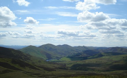
Turn left here and follow the fenceline to the top of East Cairn Hill and take in the stunning views over West Lothian and Fife. Following the same route retrace your steps back to the start.
Address
Harperrig Fishery carpark, off A70
4 miles west of Balerno
EH27 8DH
Distance: 9 miles / 14.5km with a climb of 561m
Approximate time: 4 hours
Start & finish: layby opposite Harperrig Fishery carpark, off A70, 4 miles west of Balerno
More like this
John Muir Way
The John Muir Way stretches all the way from Helensburgh in the West to Dunbar on the East Coast.
Pentland Hills Regional Park
A living working landscape with 10,000 hectares of countryside, 100km of paths and spectacular scenery.
Visit West Lothian, Civic Centre, Howden South Road, Livingston, West Lothian. EH54 6FF UK Registration No. SC346843
Great for


